A new analysis of Malaysia Airlines Flight MH370 suggests the potential crash zone in the southern Indian Ocean may be broader than previously estimated, highlighting how assumptions in earlier modelling could have influenced the underwater search.
The study, presented by independent researcher Richard Godfrey, examines how changes in aircraft trajectory modelling affect estimates of where the missing aircraft may have come down.
Flight Malaysia Airlines Flight MH370 vanished on March 8, 2014 while travelling from Kuala Lumpur to Beijing with 239 people on board. Despite extensive international search efforts, the aircraft has never been located.
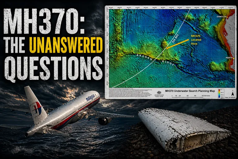
Investigators relied heavily on satellite communication data from Inmarsat to reconstruct the aircraft’s path after it disappeared from radar. The data produced a series of distance arcs indicating where the aircraft was relative to the satellite at various times, with the final “seventh arc” marking the likely area where the plane exhausted its fuel.
Based on this data, Australia’s Australian Transport Safety Bureau (ATSB) and researchers at the Defence Science and Technology Group (DSTG) conducted a probabilistic analysis that identified a most likely crash zone along the southern portion of the seventh arc, centred roughly near 38° south latitude.
That modelling informed a large underwater search between 2014 and 2017 covering about 120,000 square kilometres of seabed. A later privately funded search by marine robotics firm Ocean Infinity scanned an additional 140,000 square kilometres further north along the arc.
Ocean Infinity chief executive Oliver Plunkett has said that although the aircraft was not found, the searches provided useful constraints. “If nothing else, we can say with confidence that it isn’t where we looked,” he said.
The new analysis revisits the Bayesian statistical framework used in the DSTG study but tests how sensitive its conclusions are to assumptions about the aircraft’s autopilot behaviour after radar contact was lost.
The original model assumed the aircraft continued largely on a constant track after leaving radar coverage, with only limited possible changes in guidance mode. Godfrey’s study introduces a small modification: allowing the aircraft’s autopilot to execute a single “direct-to” navigation command toward a waypoint during the flight.
Using the same satellite timing data — known as burst timing offset (BTO) and burst frequency offset (BFO) measurements — the revised model generated alternative trajectories that still match the satellite signals but intersect the seventh arc over a wider range of latitudes.
The analysis found that such waypoint diversions could significantly expand the possible crash corridor along the arc, particularly toward the north, depending on when the manoeuvre occurred and which waypoint the aircraft was directed toward.
While the southern boundary of the potential crash zone remains close to the previously identified region, the northern range could extend much farther than earlier modelling suggested.
The study does not propose a new definitive crash location. Instead, it highlights how the assumed aircraft dynamics in the statistical model influence the resulting search distribution.
“In Bayesian search problems, the posterior distribution depends jointly on the prior data, the measurement model and the assumed aircraft dynamics,” the study notes.
Overall, the analysis suggests the feasible crash area could lie within about 100 nautical miles of the seventh arc between roughly 18° south and 38° south latitude — a region covering about 500,000 square kilometres.
To date, about 260,000 square kilometres of that area has been searched.
The findings indicate that further investigation of alternative trajectory models may refine future search planning and could help guide any renewed effort to locate the missing aircraft.
Even after more than a decade, the disappearance of MH370 remains one of the greatest mysteries in aviation history.
Here is the full epsiode.